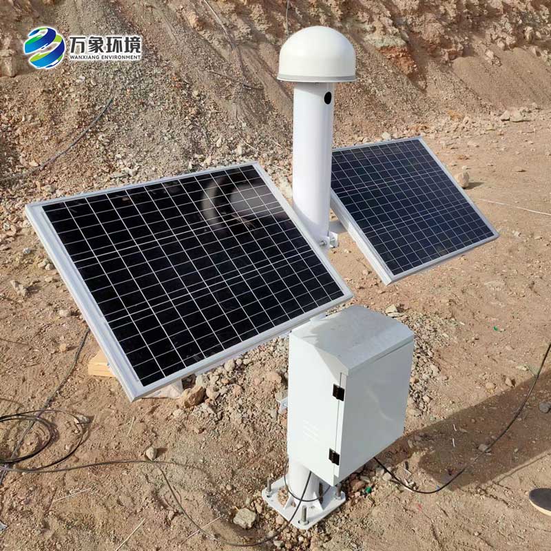
Under the dual action of nature and human activities, the land surface settlement has become a problem that cannot be ignored. Whether it is urban planning, infrastructure construction, or geological disaster warning, the monitoring of land subsidence is crucial. Now we want to introduce a revolutionary monitoring tool - surface settlement displacement monitor, how it accurately captures the surface of the "micro movements", to provide us with valuable data support?
GNSS, or Global Navigation Satellite System, uses navigation signals from multiple satellites for high-precision positioning, speed measurement and timing. The WX-WY1 surface settlement displacement monitor is a special equipment for surface settlement monitoring using GNSS technology. It can continuously monitor the small displacement changes of the surface in real time, and transmit the data to the data center for analysis and processing in real time.
The surface settlement displacement monitor adopts advanced satellite positioning technology, which can achieve millimeter-level or even sub-millimeter-level positioning accuracy. This means that even small subsidence of the surface can be accurately captured, and it can transmit data in real time, ensuring the timeliness and accuracy of monitoring results. This is particularly important for early warning of geological disasters that require rapid response. And it can work 24 hours a day, continuously monitoring changes in the surface displacement. This provides researchers with valuable data support to help them better understand the dynamics of the surface.
In the area of frequent geological disasters, the surface subsidence displacement monitor can monitor the change of surface displacement in real time, and provide an important basis for geological disaster warning. Once an anomaly occurs, emergency plans can be immediately activated to reduce disaster losses.

Article address:
http://www.qxhjjc.com/en/newcen/1085.html


 Home
Home phone
phone Product Overview
 Contact Us